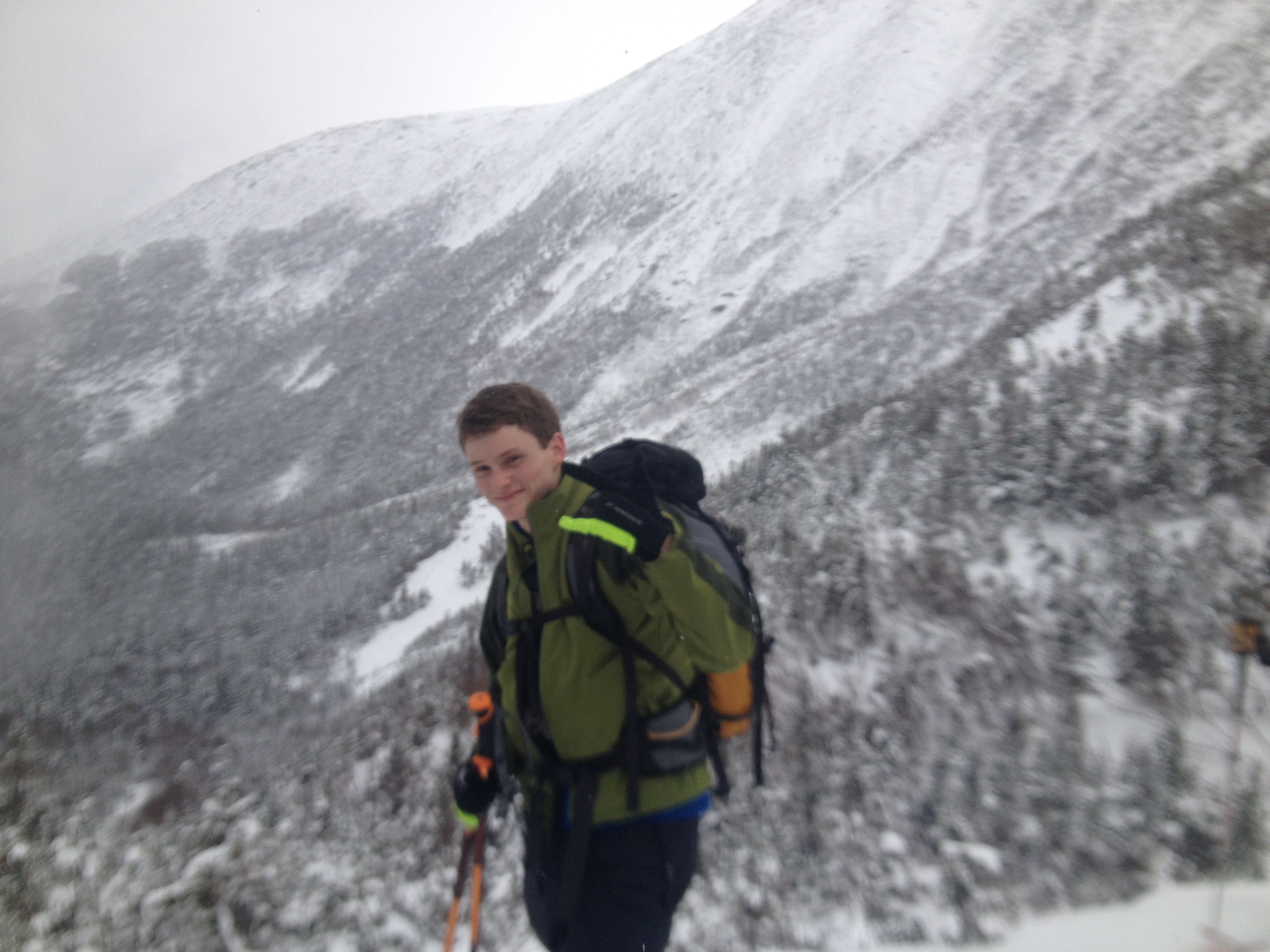
Last Sunday we finished another amazing avalanche course. Despite the lower than average snow depths we have some fascinating conditions to contend with and learn from. Long periods of intense cold have led to Persistent Slab conditions much more common in Continental snow climates like Colorado. Added extreme high winds to the equation and we have created potential wind slabs sitting on persistent slabs. A better set up for an avalanche course couldn’t be made up… well… it could have been a little warmer last weekend. However 7 equipped and motivated students attended the weekend’s avalanche course and this strong team learned a lot about traveling in avalanche terrain during Considerable conditions. We are about halfway through our avalanche course season so if you haven’t signed up for a course yet don’t delay, some of the remaining dates have already sold out:
Near Hillman’sSome old debris at the corner of Hillman’s HighwayPretty wicked conditions above treeline, -40 to -50 wind chills up there…A small natural crown in the bottom half of Hillman’s HighwayOur group, with Hillman’s Highway behind usMy field notes from Day 3Our Ski Descent on Day 3Snow-pack Observations on Day 2Snow-pack Observations on Day 2Morning Trip Planning Session on Day 3
Another great avalanche course ended yesterday. Despite being a couple feet behind in seasonal snowfall the ravine had Considerable avalanche danger for our field day.
Cool iPhone Ap, TheodoliteObservational Outing along Mt. WillardSome group trip planning at Pinkham NotchA student makes some weather observationsThe Hermit Lake snow study plotGetting ready to head into the ravineConditionsConnection Cache, visibility starting to deteriorateFiguring out how best to Travel Wisely
It’s a somber coincidence that during the first day of this season’s Eastern Mountain Sports Schools Avalanche Course season we would have our first avalanche accident of the season occur on Mount Washington. Hours after finishing our first day of mixed classroom and companion rescue field sessions a Mountain Rescue Service call-out informed me there had been two people caught in an avalanche in Tuckerman Ravine. Over the next couple of days details would emerge as to what happened. Much has already been covered by the mainstream media. Some of that coverage can be found here:
While I originally wanted to blog about how this first avalanche course went, I can’t stop thinking about this accident (and the likely future accidents this season) and want to spend my efforts addressing a couple of issues I struggle with.
How can we, as a climbing community, raise the collective bar as to what is responsible travel in the mountains?
This is not a new issue. Mount Washington has a long (perhaps the longest) history in the US of being under-estimated and deadly. Read the book “Not Without Peril” if you are interested in some of the more illustrious stories of mishaps on the mountain.
It would be tough to argue that any other mountain sees more un-skilled travelers on a yearly basis with little “mountain sense”. Some of the reasons for this are obvious; it’s relatively low elevation and accessibility to a huge portion of the US population. Other reasons are more subtle. It’s clear that hikers/climbers push on in adverse conditions when they would not on any other mountain, instead relying on the closed summit buildings and weather observers, and the closed auto road, to provide a margin of safety that might allow them to still bag the summit (but then need help getting back down).
What frustrates me is the amount of education available to the general public that seems to get ignored on a daily basis. Detailed mountain weather forecasts, professional avalanche bulletins, trail information specialists, qualified guide services… all at our finger tips but often not taken into consideration for a climb on this mountain that has seen so many accidents.
Before I go further and people start thinking I am just wagging my finger I recently read, and shared, a great blog post on “Changing the Culture of Shame“. The message is when we, the climbing community, play “Monday morning quarterback” and start saying “That would never happen to us they were reckless, etc. etc.” we discourage the victims from taking ownership of their ordeal, sharing their experience, and helping other’s learn from their mistakes. I agree with this sentiment to a point, by I also think complete absolution from blatant mistakes inhibits the same potential positive outcomes of an accident.
In reading all the reports on this accident in the various regional news papers and watching video blogs a common theme presented itself. The media often romanticizes these victims in their stories. Some of the titles would probably elicit a hometown hero’s welcome. A few media outlets, especially the local ones, were more accurate in their stories;
“The hikers triggered an avalanche” vrs “The hikers were caught in an avalanche”.
There’s a big difference in these two statement in terms of responsibility, but avalanche awareness (or lack of) wasn’t the root cause of this accident. Lack of general mountain sense was.
The group split up due to impending darkness and lack of headlamps. They did not have map & compass (and by inference the ability to use them). While not a major contributing factor they had inadequate footwear and traction for climbing Mount Washington this time of year. The media has been referring to them as “hikers” instead of “climbers”, to the approval of many vocal online climbing forums, but this is an issue of semantics. Basically they were somewhat prepared (ice axe, goggles, proper clothing), but lacking “essentials”, navigation skills, team work, communication, “mountain sense”.
Whether we call them hikers or climbers it doesn’t matter. They were woefully under-prepared and made bad decisions recognizable by the vast majority of the climbing community. But I’m not sure what the best way to reduce the amount of these type accidents. My gut tells me we are in for a tough winter with already 5 Mountain Rescue Service calls before the New Year; we are well ahead of average. Every year our avalanche accidents seem to increase.
I’ve changed my previous opinion that charging for rescues can be an effective deterrent. Education, it seems should be the best option. Education has increased driver safety, lowered STD transmission, reduced teen-pregnancy and drug use, it should be able to help keep us safer in the mountains. But there is a resistance to education in the mountains. It’s ironic, as there are more guide services, independent guides, outdoor education programs, online resources, climbing clubs, etc. than there has ever been. Yet the overall culture is not changing fast enough. Everyone, from the victims, the rescuers, the media, and fellow climbers, need to ask themselves how they can help shift the balance to a more responsible use of the mountains. The answer for each will undoubtedly be different, but important.
The photos from this weekend’s avalanche course:
Companion Rescue practice during avalanche course
Observational Outing during Avalanche Course
Weather forecast for our tour day on avalanche course
Trip Planning during avalanche course
First Avalanche Course of the Season
Field Book from Tour Day on Avalanche Course
Avalanche Course info and dates for the rest of the season are here:
As the last hours of 2013 are upon us take a quick inventory of your skill set in the mountains. What do you need to brush up on? What resolutions can you make for a productive, safe, fun 2014 climbing/skiing season?
Thanks for reading, please subscribe at the top right if you’d like to follow the progression of avalanche courses I’ll be facilitating this season.
While winter is not quite done with Mount Washington we finished our last avalanche course of the season this past weekend. Looking back on the season I can say with no embellishment that this has been a banner year for me along with the EMS Schools Avalanche Course Program.
We ran 11 AIARE 1 courses and 1 AIARE 2 course this winter. That’s 114 AIARE students! From our first course at the end of December to our last course that ended April 1st Mother Nature has provided excellent snow conditions for learning about safer travel in the back-country. In mid-January we had 4 EMS School guides travel out west to take an Instructor Training Course in Steven’s Pass, Washington. We are now the largest avalanche course provider in the East with 3 certified AIARE 1 Instructors and 1 AIARE 2 Course Leader on staff. That is exciting as we strive to meet the growing demand of back-country travelers seeking avalanche education!
Human involved avalanches on Mount Washington appear to be on an increase. Early this year a 12 person group triggered an avalanche in Central Gully that caused significant injuries and has stirred up quite a bit of debate.
An accident report from the USFS can be found here.
Then on March 1st a tragic event unfolded on Pinnacle Gully when a solo climber triggered an avalanche that caused him to fall and sustain fatal injuries.
Crown line is visible in this photo just below the rock constriction.
The accident report for this can be found here. That same afternoon an experienced mountain guide was ski descending Lobster Claw Gully in Tuckerman Ravine when one of his clients triggered a size-able slab that carried the guide who was able to self-arrest successfully and did not result in injury.
Just yesterday a skier triggered a rather large hard slab in the Lower Snowfields that could have easily taken a life.
The Avalanche Danger rating for the day for all three of these incidents was “Moderate”. Nationally most human involved accidents happen during “Considerable” danger, but Mount Washington is quite different from our western back-country areas in both terrain and user group make-up.
The Mount Washington Avalanche Center forecasts on a “micro” scale, gully by gully, which may lead some climbers with limited avalanche education into a simple “Moderate means I can do it, Considerable means I can’t” kind of mind frame. The bottom line is “Moderate” means that while natural avalanches are unlikely, human triggered slides are possible. This means the traveler needs to be able to recognize signs of unstable snow, trigger points, terrain traps, etc. in order to move through that terrain.
Our user group is a bit of a factor as well. We have a disproportionate amount of highly skilled technical climbers with limited knowledge related to traveling in avalanche terrain. We’re an area known for breeding world class alpinists. New climbers can learn to competently climb Grade 4+ ice in just a season. They may master rope-systems and technical ice climbing but not understand the differences in wind slab or storm slab.
EDIT: 4/9/2013 USFS Ranger Chris Joosen just posted about “Moderate” and it’s implications in our area. It is very relevant and the post can be found here.
I took my first avalanche course 11 years ago after watching two climbers die in an avalanche in Tuckerman Ravine. I left that course, and subsequent courses, with a healthy dose of irrational fear and an inability to really “put it all together”. After years of practice and learning from experienced avalanche educators around the country some light-bulbs started to go off. I could go on about this for awhile, but I want to sum it up in one sentence.
Avalanche courses today are not like avalanche courses 10 years ago!
The good news is we, as a culture, are learning that. Word of mouth is spreading from partner to partner that a modern formal avalanche course is a wise investment for anyone who wants to spend time in the winter mountains. It goes without saying that what you do with the skills after you leave the course will determine whether or not you are any “safer”. Quality experience is as important as theoretical knowledge! However all the feedback forms this season indicated that time in the course was well spent and provided a great foundation for a life-time of learning!
While I still plan on getting quite a few more days up high skiing this season, I look forward to next winters avalanche course season. I’ll be heading back out west again to get updated in an AIARE 2 Instructor Refresher Course at some point and we’re tweaking some logistics and gear issues at the school to make our courses even more efficient and effective.
To all participants from this season, thank you. Your engagement in the learning process has helped me become a more effective course leader, and I hope to see you all out on the mountain!
Yesterday wrapped up our 2nd to last AIARE 1 Avalanche Course. 10 participants enjoyed mid-winter snow conditions after a late March snowstorm dumped over a foot of fresh on the mountain. Field conditions were perfect to learn about decision making in the back-country.
EMS School Guide Keith Moon addresses the group before we head out on an observational outing on Day 2Heading out to the southeast side of Mt. Willard for some field workEMS School Guide Keith Moon demonstrates how to measure slope angle in the field, an important component in Terrain SelectionHeading out on our Ski Tour on Day 3174cms of snow at the Hermit Lake snow stakeConducting a quick hand-shear test below Connection CacheEntering Tuckerman Ravine with the very large crown visible in the bowl…Spreading out and ascending up towards Right GullyChecking out the layering on a 34 degree SSE slope at 4,400ftWildcat in the backgroundOur pit locationA shot of the crown before descending the Little HeadwallDay’s tour notesKeith facilitates a course debrief
Well our last avalanche course of the season is next weekend, and temps look to be staying below freezing up high and snow showers are expected up there tonight and tomorrow so our snow-pack should stay dynamic for the last course, which has 1 spot left in it. So… last chance… if you wanted to get this course in this season call the school office now! 800-310-4504!
Today wrapped up another AIARE 1 Avalanche Course with interesting snow-pack conditions and great weather, Mother Nature is really keeping the avy course season going strong this year! Our first day focused on recognizing avalanche terrain and learning about the different types of avalanches along with what to do if someone in your party is caught in an avalanche. On Day 2 while we learned about how dynamic the winter snow-pack can be we stepped outside early morning to look at some beautiful 3mm Stellar snow crystals, and talked about how they could act as a buried weak layer in some situations:
Intact Stellars
Later that day we went on a short tour along the south east side of Mt. Willard and saw some great wind effected snow, deep “whales” from earlier intense blowing snow, shooting cracks on some small slabs, and evidence of last weeks rain event.
Today we met at Pinkham Notch Visitor Center, and after a trip planning session we skinned up to the snow study plot below Hermit Lake.
143 cms of snow at the stake…
After we got our first look at the Ravine we re-fueled with some food & H20 then headed up into the floor of Tuckerman Ravine.
BluebirdSkinned up the Tuckerman Ravine Trail
Along the way we had some interesting Hand Shear results along with positive ski cuts that produced impressive shooting cracks. We were happy that we were on low angle terrain given those results!
Once we reached the floor we soon noticed a size-able crown below The Chute. USFS Snow Ranger Jeff Lane was investigating it by conducting tests in the crown and exploring higher above it while fellow snow ranger Frank Carus spotted him from over by Right Gully.
Can you find the crown, or Jeff?A zoomed in shot of the crown… it’s lower far edges reach almost both sides of the frame…
Sticking to our original tour plan we started heading up a skin track to Right Gully.
Kick-turns & some exposure…
We stopped to the right of the mouth of Right Gully for a closer look at the snow-pack.
Great position in the bowl
Results were quite impressive, as we got repeated CTE, Q2 40-60cm down (depending on which pit), on an almost indistinguishable layer interface (wasn’t the crust from the previous weeks rain). This matched up with what USFS Snow Ranger Frank Carus had shared with us on our ascent, and was enough evidence for us that even though the bulletin only put Right Gully at “Moderate” it was above our level of risk acceptance to enter the gully proper. We decided to ski one at a time from this high point back to the floor of the ravine. 3 turns into the slope I buried a ski in the heavy snow and face planted pretty hard… first fall of the season! Given the pit results I did look up quickly to make sure my tumble didn’t tip the scale, but all was well and worth a chuckle.
Spotting the last couple people in our group from outside the run out…
After we regrouped at the floor of the ravine we made for the Little Headwall, which had a few dicey spots as last weeks rain had blown it out and there were some gaping holes that required some careful navigation. The rest of the Sherbie was pretty enjoyable, though the bottom half will be very happy with the new snow coming tonight into tomorrow!
My tour notes from the day:
Well, only 2 courses left this season. Next weekend’s course has 1 or 2 spots left in it. If you want it you can book it online here. This incoming storm is sure to produce great conditions for the next course, which can be hit or miss this late in the season!
“Spring is in the air” would be a common theme as we hit near record highs during our 8th AIARE 1 Avalanche Course of the season which concluded today. Despite the warm temperatures our snow-pack is certainly still dynamic as we got to experience a wide variety of conditions in the three days we spent together. Day 1 saw some productive morning discussions about different types of avalanches and avalanche terrain in general before heading outside for some great companion rescue practice.
Day 2 was VERY interesting as despite the warm temps it was very cold, clear, and calm the night before… so driving up to the Highland Center I was a bit excited to see obvious Near Surface Faceting all over the place from Bartlett to the Highland Center. I was even more stoked to see aggressive Surface Hoar all over the field right next to our classroom. I realized the warm temps and strong solar radiation expected would destroy it early so I grabbed some pics with my iPhone before class started.
Surface HoarSurface HoarSurface Hoar
While I have found small pockets before this stuff is a bit rare here in our windy “Arctic Maritime” snow climate and this was the largest area I have ever seen covered in it. Some of them measured 5mm in height, which is pretty impressive. An hour and a half later when we left the classroom to check it our the daytime warming and sun had destroyed it. I was glad to have the photos!
That afternoon we headed south along the east side of Mt. Willard and quickly noticed some huge “pinwheeling” from the strong solar radiation we where getting. I would call it “prolific” as it was everywhere. In some areas it looked like debris, but was just massive amounts of “pinwheels” and “rollerballs”. Some where quite big!
BIG pin-wheel!
Other than just indicating strong solar radiation these little features can often preclude wet loose snow avalanches, and possible wet slabs if unstable conditions exist. On a slope covered in pinwheels Keith demonstrated measuring slope angle with his ski poles.
SE Side of Mt. Willard, 1880ft
Minutes later we wrapped around to the more southern exposure of Mt. Willard and found fresh debris from a small slab avalanche that came down just to the right of Cinema Gully and almost reached the train tracks…
Small debris pile near Cinema Gully
We finished the day looking at some layers on a small NW slope and found some buried Melt-Freeze crusts with free water sitting on top. Compression Tests were rather inconclusive.
Keith demonstrates a Compression Test
Day 3 started at the Pinkham Notch Visitor Center. After accessing the bulletin we made a trip plan for Tuckerman Ravine.
Setting out from Pinkham Notch Visitor CenterMaking some observations at the Hermit Lake snow study plotOur first view of the bowl
At HoJo’s we chatted with Lead USFS Snow Ranger Christopher Joosen about the conditions and his and his fellow rangers job on the mountain, then we continued up the Tuck’s trail towards are original objective of Lobster Claw Gully.
Ranger chatRight side of the bowl
We bumped into Frank Carus, another USFS Snow Ranger who pointed out an almost indistinguishable old debris pile that had come out of Lobster Claw the week before.
USFS Snow Ranger Frank Carus
After some group discussion the majority voted to change our plan due to the strong solar radiation and warm temps possibly making things a bit iffy on the right side, and fell back on our more conservative plan to head over towards Left Gully and The Chute. The decision was made to spread out when crossing the main run-out.
10 meters apart looks differently to some 😉
We got a good vantage to see the debris and the crown at the top of Right Gully from the skier triggered avalanche the day before.
Crown is hard to see, it is top left of gully and we could see the ski tracks from the skier who triggered it…
We chose the slope between Left Gully and The Chute to poke around. We got some super positive hand shear results on a 25cm pencil hard slab sitting on graupel that was mentioned in Friday’s bulletin. That got us excited to dig further and we got tons of positive CT results along with a RB4, MB. A student sent me this video of the Rutchsblock.
I’ll upload the hand shears and Compression Tests later.
After we descended via Little Headwall and Sherburne we had a good course close back at PNVC. I stuck around for the annual NH Search & Rescue dinner and a great presentation by the Director of Summit Operations, Cyrena-Marie Briede, on her work in Alaska.
Full house
More to come on this event, along with the videos from the Handshears, CT’s, and Rutschblock tests so please check back!
Last Friday, March 1st, we started another 3-Day AIARE 1 course. March 1st seems to be a dangerous day, as just 2 years ago a very experienced skiier took a huge ride in Gulf of Slides. This year a very experienced local climbing guides party triggered an avalanche while he was ski guiding in Tuckerman Ravine and a solo ice climber triggered an avalanche in Huntington Ravine that was fatal. Until I see official reports from the USFS I am with-holding talking more about these incidents but I will update links here as more info becomes available. In the meantime let’s reflect on the tragedy that has occurred; a 24 year old climber has lost his life pursuing his passion. Without a doubt lessons will be learned for this, but let none of us think we couldn’t have made the same mistakes of either party.
As usual we met at the AMC Highland Center in Crawford Notch. After introductions we took a look at the Gulf of Slides case study before breaking into small groups to learn what we could from the incident and consider a structured decision making process like AIARE’s “DMF”.
Deep in thought
That afternoon we spent a few hours outside practicing Companion Rescue, i.e. how to efficiently rescue your partner if they are buried in an avalanche. After some classroom the morning of Day 2 we drove over to Marshfield Station at the base of the Cog Railway to begin our Observation Outing. After a weather observation and beacon function check at the trail-head we started our ascent.
EMS Guide Keith Moon and the AMC’s Jerome lead the pack…
We soon noticed some interesting Surface Hoar growing on some twigs, and along the rails of the Cog and to a small extent the closest snow surfaces to the railway.
While I tried to wrap my head around why this was so prolific during considerably overcast conditions we climbed up to 3,800 feet and took another weather observation at Waumbek Tank. About 45 minutes later we arrived at our high point objective, Jacob’s Ladder, and poked around in the snow a bit looking at the layering and learning about Hand Hardness scales and Compression Tests.
285cms of snow just left of Jacob’s LadderGetting ready to descend
It was a pretty sweet ski back down to the trail-head where we reviewed our choices and expectations and made plans for the following day on the other side of Mount Washington.
The next day we met at Pinkham Notch Visitor Center and broke into small groups again to work on a trip plan for the day. The avalanche bulletin for the day was complex, and even included the line “The avalanche conditions are paydirt for avalanche practitioners, guides, and educators.” Perfect for our goals of moving through complex avalanche terrain, making observations about snowpack, weather, and avalanches!
Heading up the Tuckerman Ravine trailChecking out the snow study plot below Hermit LakeChatting with USFS Snow Ranger Frank Carus
After reviewing our trip options created that morning and updating our weather expectations we decided we could stick to Plan “A” and set a skin track up the Little Headwall to get into the ravine.
Keith sets a track up the Little HeadwallBill Jr. realizes kick-turns take more than just great fitnessAlex takes a breatherBill Jr. with the 2008 Hillman’s Highway D4 destruction and the Hurricane Irene landslide path behind him…
With the majority of the ravine rated “Considerable” we stayed low and traversed the main run-out by spreading out with eyes on the start zones of anything that looked sketchy…
Seems my water-proof iPhone case had some moisture in it as this came out quite blurry…We dug into a small north east slope below and to the left of Left GullyBill Jr. decides between 4F or 1FEMS Guide Keith Moon coaches snowpack observations while a large group enters the ravine below
We got some interesting Compression Test results and a eye-opening Rutshblock (RB3 MB 18cm down followed by RB4 MB 38cm down). Unfortunately we didn’t film it. After wrapping up our observations we dropped the Little Headwall and enjoyed the packed powder run down the Sherbie… back at PNVC we debriefed the day and the course in general. My esoteric field notes from the day;
Well, only 4 weekends left to the avalanche course season, two are sold out. Winter is not leaving as fast as it did last year. Safe “Spring Skiing” conditions were already here this time last year, but are weeks away looking at the long range forecast. Read the bulletin. If you are unsure, scale back your ambition, and come back when conditions match your confidence and understanding!
Last night I got home after conducting an AIARE 1 Course with fellow guide and manager of our Lake Placid EMS Schools location, Dan Sandberg over in the High Peaks region of the Adirondacks. It was great to work with Dan in an area I was not familiar with. Even better, a size-able Nor’ Easter commonly called “Nemo” in the major news outlets arrived the same night I did and laid down close to two feet of snow for us to recreate on.
Dan had arranged a great classroom space at the Adirondack “Loj”, a great facility run by the Adirondack Mountain Club, very similar to our local AMC Highland Center and Joe Dodge Lodge.
Getting settled in for some morning classroom on Day 1
11 students, including EMS Schools Guide Dustin Ulrich, 3 EMS Store Guides from our Middletown, RI and Nanuet, NY stores, an educational trip leader and hut manager for ADK, an Adventure Education Major, a couple military guys, and all around winter sports enthusiasts all helped create a great environment to start learning about decision making in the back-country.
On our 2nd Day we toured up the Memorial Highway on the north-side of Whiteface Mountain.
Ski-cutting a low angle slope
Along the way we practiced making weather observations and quick snow-pack observations like pole probing, ski-cutting, and boot penetration in the cold new storm snow that had blanketed the area. Unstable snow was definitely around as we experienced some whumping and were able to get small shooting cracks on some convex areas off to the side of the road. We were quite safe as we kept our slope angle well below anything risky. After looking more closely at the snow at 3,800 feet and learning about tilt tests, hand hardness scale, and compression tests, we enjoyed the 3.26 mile glide back down to the parking lot.
Whiteface Tour
Later I shared my field observations with the group and we talked about the relevancy of our results.
Not the best handwriting… I know
On the 3rd day we spent some time in the classroom looking at some avalanche terrain and figuring out possible route selections based on conditions, and talked about travel techniques to help further mitigate risk. One of the bigger challenges of carrying out an avalanche course in the Adirondacks is the access to the actual avalanche paths is a bit remote, so we decided it would be more valuable to get some more Companion Rescue practice in on the last day and headed out across Heart Lake to a nice back-country ski trail to run through some more detailed rescue scenarios.
Heading out across Heart Lake
I took some video of one of the scenarios and uploaded it here:
A disclaimer, we only had the recent 18 inches of snow to practice on so we could not bury the beacons at a realistic depth. I also threw a big curve-ball at this group with a surface victim which ended up creating some great discussion on the realities of a possible rescue. The next run these three did went a lot smoother. Everyone in the course walked away feeling this was something they could practice a lot more of with their friends, and that was exactly what we hoped!
I must admit I was concerned about meeting all the learning objectives of an AIARE 1 Course in an area I wasn’t familiar with especially with very low snow depth in relation to seasonal norms there. Based on the course feedback forms we received we met our goals, and that, combined with co-teaching with a new instructor, and excellent constructive feedback from the participants, made this course a huge personal learning experience and I’m excited to return next winter for another course in the Dacks’!
Now it’s time to start prepping for the AIARE 2 Course that starts this Friday.
If you enjoy these course reports the best way you can let me know is by subscribing at the link top right. The 2nd best way if you don’t want to subscribe is to leave a quick comment… especially if you were in the course!
Yesterday wrapped up the 3rd avalanche course of the season and the first course with recently AIARE 1 instructor certified EMS Schools Guide Mike Lackman co-teaching. Mike had joined me for the Instructor Training Course in Stevens Pass a few weeks ago and it was great to have a co-instructor to work with over the last three days!
Twelve participants from Canada, Maine, New York, Massachusetts and Ohio joined us at the AMC Highland Center for two days of classroom and field sessions to learn about decision making in avalanche terrain before heading up into Tuckerman Ravine to put it all together on Day 3.
After we wrapped up our field session on Day 1 some of us headed to Frontside Grind in North Conway where the recently formed Friends of Mt. Washington Avalanche Center was hosting a fun slideshow/fundraiser. Free beer, Tuckerman Pale Ale of course, delicious pizza provided by The Flatbread Company, great silent auction, and a really informative slideshow showing some of the history of the Avalanche Center entertained a standing room only venue.
Evening presentation by USFS
The next day after some morning classroom we headed through Crawford Notch to look at some avalanche paths and make some snow & weather observations.
Day 2 Observational Outing
During our Observational Outing we found significant wind slab, wind crusts, and some great Surface Hoar in a sheltered area not far from the above photo. Later in the day we got some interesting Compression Test results in our shallow faceted snowpack. Despite being behind in snow totals for the month of January we still have a very interesting snowpack to learn from!
Day 3 we gathered at Pinkham Notch Visitor Center and after working in small groups to come up with a trip plan for the day we headed up in to Tuckerman Ravine. Mother Nature was temps struggled to reach double digits and wind chills made goggles and face masks quite necessary above Hermit Lake. Visibility however was excellent and we viewed quite a bit of terrain, along with a very fresh crown line at the top of the bowl. Digging around in the snow below Right Gully provided another chance to look at layering in the snowpack, and by 2:30pm we were starting our descent back to PNVC and a productive course wrap-up.
Group photo at HoJo’s before skiing down the Sherbie…
With last weeks 12 person avalanche in Central Gully lots of former students have asked my opinion. I think Jeff Lane’s well written accident summary pretty much echos my thoughts, so I’ve linked it here.
Next weekend we are not running an avalanche course, but I have a 2 day private ice climbing course and a 3 day mountaineering program scheduled. The following weekend I will be heading to Lake Placid to teach an AIARE 1 Course in the Adirondacks. If you are interested in hearing how these pan out, personal product reviews, and about future avalanche courses in the White Mountains please subscribe to this blog’s email list by entering your email address in the top right of the blog.